Profile
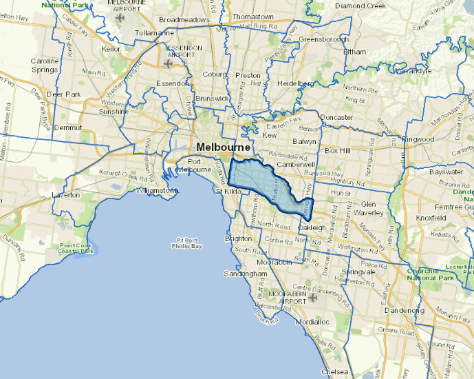
The City of Stonnington, located in Melbourne’s inner south-east, alongside the Yarra River, spans 25.63 square kilometres. It includes the suburbs of Armadale, Kooyong, Malvern, Malvern East, Prahran, Toorak and parts of Glen Iris, South Yarra and Windsor.
Stonnington is primarily a residential area, with some commercial and industrial areas. It is well known for its shopping and lifestyle precincts, parks and gardens, leafy streets, and historical architecture.
Stonnington is home to 19,351 businesses, which contribute to the city’s vibrancy and prosperity. Key sectors driving Stonnington’s economy include professional, scientific, and technical services, health care, and construction.
Council information
Vicmap Basemap Services @ 2023 State Government Victoria | Copyright and Disclaimer
For a detailed map showing shire boundaries and locality names, visit VICNAMES.
Localities
Armadale, Glen Iris, Hawksburn, Kooyong, Malvern, Malvern East, Prahran, South Yarra, Toorak and Windsor.
Updated