Profile
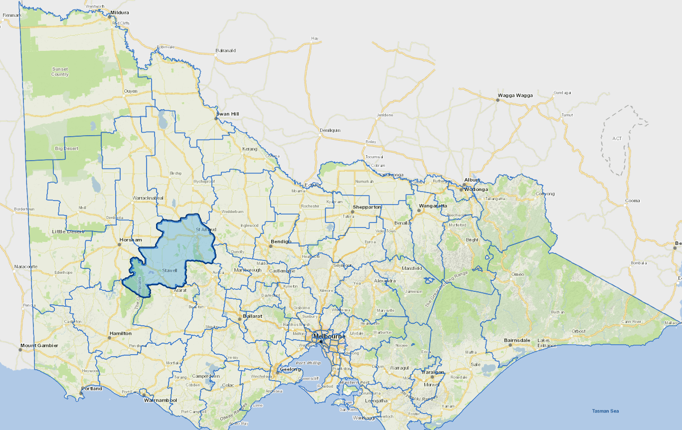
The Northern Grampians Shire is located to the north east of the Grampians and about 230 kms north west of Melbourne.
Its economy is based on agriculture, gold mining, tourism, wine production and manufacturing. Stawell, the main centre, is home to brick, textiles and meat production, while the Grampians area is a popular holiday destination.
The main industries include agriculture, metal ore mining, meat and meat product manufacturing, other food manufacturing.
Council information
Vicmap Basemap Services @ 2023 State Government Victoria | Copyright and Disclaimer
For a detailed map showing shire boundaries and locality names, visit VICNAMES.
Localities
Archdale, Archdale Junction, Avon Plains, Banyena, Barkly, Beazleys Bridge, Bellellen, Bellfield, Black Range, Bolangum, Bridge Inn, Brimpaen, Bulgana, Callawadda, Campbells Bridge, Carapooee, Carapooee West, Cherrypool, Concongella, Coonooer Bridge, Coonooer West, Cope Cope, Crowlands, Dadswells Bridge, Dalyenong, Darkbonee, Deep Lead, Dunneworthy, Elberton, Emu, Fyans Creek, Germania, Glenisla, Glenorchy, Gooroc, Gowar East, Grays Bridge, Gre Gre, Gre Gre North, Gre Gre South, Great Western, Greens Creek, Halls Gap, Illawarra, Joel Joel, Joel South, Kanya, Kooreh, Laen, Laharum, Lake Fyans, Lake Lonsdale, Landsborough West, Ledcourt, Logan, Lubeck, Marnoo, Marnoo East, Marnoo West, Mitchells Hill, Mokepilly, Moolerr, Morrl Morrl, Mount Dryden, Moyreisk, Natte Yallock, Navarre, Paradise, Pomonal, Redbank, Riachella, Rich Avon East, Rich Avon West, Roses Gap, Rostron, Rupanyup, Shays Flat, Slaty Creek, St Arnaud, St Arnaud East, St Arnaud North, Stawell, Stuart Mill, Sutherland, Swanwater, Swanwater West, Tottington, Traynors Lagoon, Tulkara, Wal Wal, Wallaloo, Wallaloo East, Wartook, Wattle Creek, Winjallok, York Plains and Zumsteins.
Updated
