Profile
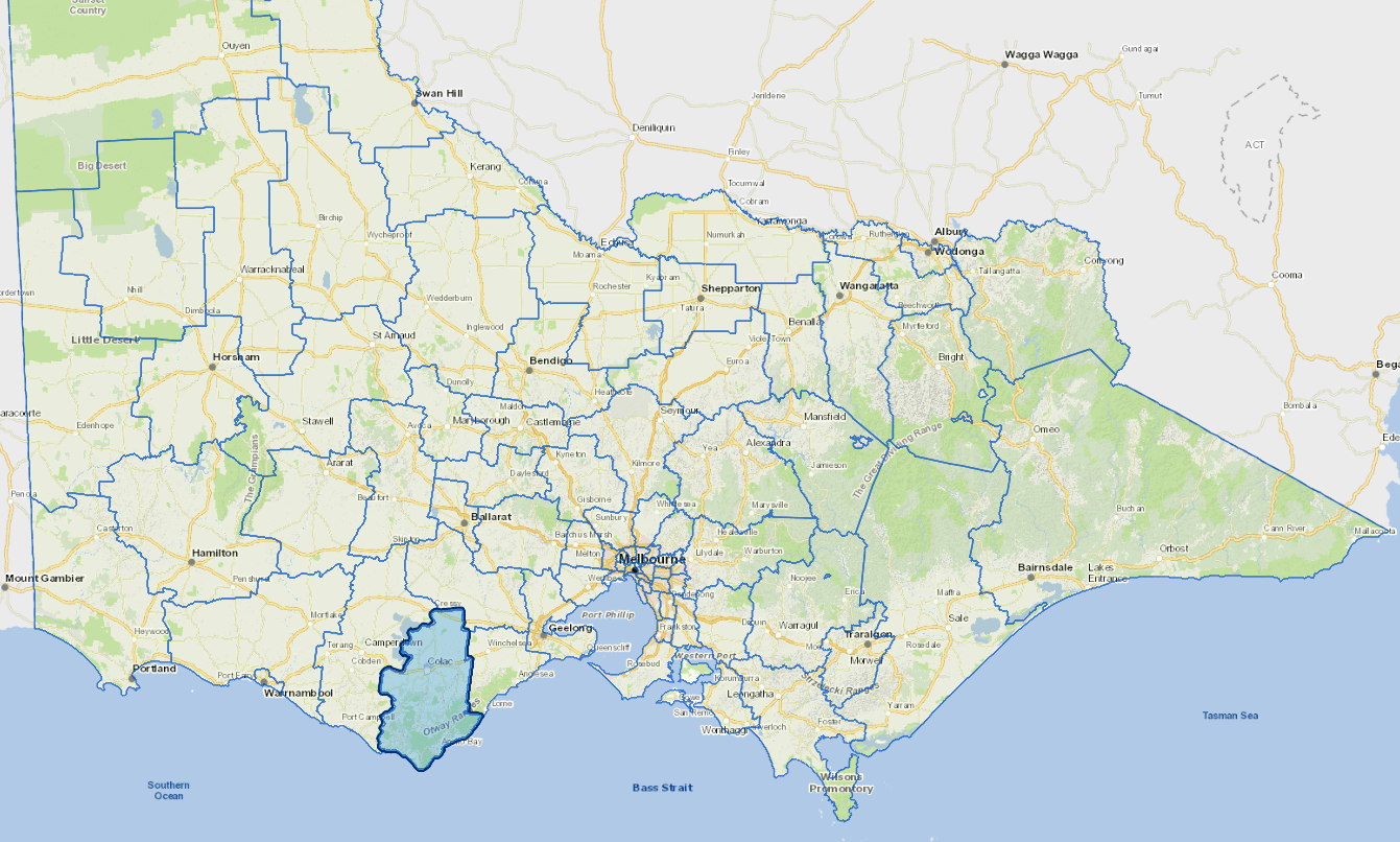
Located in Victoria’s south west, Colac Otway Shire is diverse with volcanic lakes, craters and plains in the north, the hinterland forests of the Otway Ranges and the Great Ocean Road coastline.
Colac is situated beside Lake Colac, on the Princes Highway, 160 kms west of Melbourne and within a commutable distance from Geelong. The Shire is built on agriculture, manufacturing and tourism with employment growing in the health sector.
Diverse industries include dairy, beef, sheep, crops, specified pastures, horticulture and organic farming; timber, manufacturing and service, construction and retail.
Council information

Vicmap Basemap Services @ 2023 State Government Victoria | Copyright and Disclaimer
For a detailed map showing shire boundaries and locality names, visit VICNAMES.
Localities
Aire Valley, Alvie, Apollo Bay, Balintore, Barongarook, Barongarook West, Barramunga, Barwon Downs, Beeac, Beech Forest, Birregurra, Bungador, Cape Otway, Carlisle River, Carpendeit, Chapple Vale, Colac, Colac East, Colac West, Coragulac, Cororooke, Corunnun, Cressy, Cundare, Cundare North, Dreeite, Dreeite South, Elliminyt, Eurack, Ferguson, Forrest, Gellibrand, Gellibrand Lower, Gerangamete, Glenaire, Grey River, Horden Vale, Irrewarra, Irrewillipe, Irrewillipe West, Jancourt East, Johanna, Kawarren, Kennedys Creek, Kennett River, Larpent, Lavers Hill, Marengo, Mount Sabine, Murroon, Nalangil, Ombersley, Ondit, Pennyroyal, Petticoat Creek, Pirron Yallock, Separation Creek, Simpson, Skenes Creek, Skenes Creek North, Stonyford, Sugarloaf, Swan Marsh, Tanybryn, Warncoort, Warrion, Weeaproinah, Weering, Whoorel, Winchelsea, Wingeel, Wongarra, Wool Wool, Wye River, Wyelangta, Yeo, Yeodene and Yuulong.
Updated